|
|
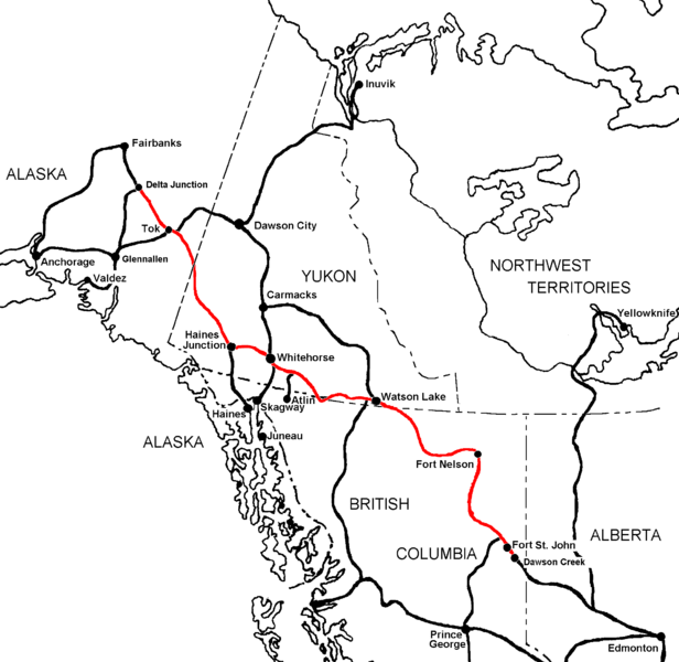
Alaska Highways and Maps Visitors traveling to Alaska by automobile or by motorhome must come through Canada on the Alaska Highway and/or the Alcan Highway unless they catch a ferry on the Alaska Marine Highway and come up the inside passage. The overland highways are generally in good shape and paved unlike in the old days when most of the highway from the lower 48 to Alaska was a dirt road. The ALCAN or Alaska Highway The Alaska Highway (also known as the Alaskan Highway, Alaska-Canadian Highway, or ALCAN Highway) was constructed during World War II and connects the contiguous U.S. to Alaska through Canada. Technically speaking the Alaska Highway runs from Dawson Creek, British Columbia to Delta Junction, Alaska, via Whitehorse, Yukon. However, many people think of the highway as starting when you cross the Washington state border at one of several crossing points. Completed in 1943, it was 2,237 km or 1,390 mi long, but is becoming shorter due to rerouting. The historic end of the highway is near milepost 1422,where it meets the Richardson Highway in Delta Junction, Alaska, about 160 km (99 mi) southeast of Fairbanks. Mileposts on the Richardson Highway are numbered from Valdez, Alaska.
Highway Maps
Serving Alaskans
Since 1996 |
|
This Site Maintained by Alaska Internet Marketing, Inc.
